

Title
Glacier Inventory
Abstract
Long-term glacier area change in Eurasia Cryosphere region is clarified by integration of topographical maps and aerial photographs and satellite image. The method of extracting glacier information is developed by automatic recognition technology of a images
Data Set Citation
Dataset Creator
Hironori Yabuki
Dataset Title
The glacier area of distribution from the topographical map created based on the aerial photograph for 1945 - 47. (sample version)
Dataset Release Date
2008-01-10
Version
sample version
Other Citation Details
Yabuki, H. (2007) Glacier distribution in 1945-47 at Mongolian Altai Mountains (sample version). Data Integration and Analysis System in Japan Agency for Marine-Earth Science and Technology, Yokosuka, Japan.
Personnel
Role
DIF AUTHOR
Contact
dmo@jamstec.go.jp (dmo@jamstec.go.jp)
Role
TECHNICAL CONTACT
Contact
dmo@jamstec.go.jp (dmo@jamstec.go.jp)
Keyword List
ISO Topic Category
GEOSCIENTIFIC INFORMATION
Parameter
EARTH SCIENCE>CRYOSPHERE>GLACIERS/ICE SHEETS>GLACIERS
EARTH SCIENCE>CRYOSPHERE>GLACIERS/ICE SHEETS>GLACIERS>GLACIERS TOPOGRAPHY
Platform
Other
JAMSTEC
Location
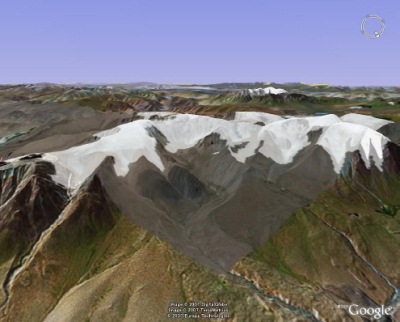
CONTINENT>ASIA>EASTERN ASIA>MONGOLIA>Altai Mongolian area
Project
Short Name
DIAS
Long Name
Data Integration and Analysis System
Quality
This data set extracts glacier distribution of the Altai Mongolian area based on the topographical map (1/100,000) which the Soviet Union army created based on the aerial photograph in 1945 - 47. The extraction method performed on GIS glacier distribution indicated to the topographical map by manual work.
Access Constraints
Please see to the Related URL for the data file.
Language
JAPANESE
ENGLISH
Originating Center
JAMSTEC
Organization
Organization Type
ORIGINATOR
Organization Name
Short Name
JAMSTEC
Long Name
Japan Agency for Marine-Earth Science and Technology, Japan
Personnel
Role
TECHNICAL CONTACT
Contact
dmo@jamstec.go.jp (dmo@jamstec.go.jp)
Related URL
Description
The glacier area of distribution from the topographical map created based on the aerial photograph for 1945 - 47 (sample version)
Last Metadata Revision Date
2022-11-18