

Title
Global Width Database for Large Rivers
Abstract
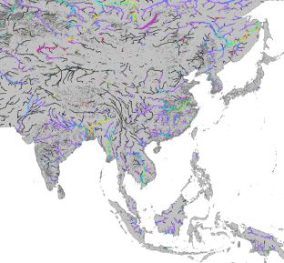
River width is a fundamental parameter of river hydrodynamic simulations, but to date no global-scale river width database based on observed water bodies has been available. Here we present a new algorithm that automatically calculates river width from satellite-based water masks and flow direction maps. The Global Width Database for Large Rivers (GWD-LR) is developed by applying the algorithm to the SRTM Water Body Database and the HydroSHEDS flow direction map.
Data Set Citation
Dataset Creator
Dai Yamazaki
Dataset Title
Global Width Database for Large Rivers
Dataset Release Date
2014-08-15
Version
version 1.2
Other Citation Details
Development of the Global Width Database for Large Rivers, Dai Yamazaki, Fiachra O'Loughlin, Mark A. Trigg, Zachary F. Miller, Tamlin M. Pavelsky, & Paul D. Bates, Water Resour. Res., vol.50, pp.3467-3480, 2014, DOI: 10.1002/2013WR014664
Online Resource
Personnel
Role
TECHNICAL CONTACT
Contact
Dai Yamazaki Department of Integrated Climate Change Projection Research/JAMSTEC (d-yamazaki@jamstec.go.jp)
Role
DIF AUTHOR
Contact
dmo@jamstec.go.jp (dmo@jamstec.go.jp)
Keyword List
ISO Topic Category
INLAND WATERS
Parameter
EARTH SCIENCE>TERRESTRIAL HYDROSPHERE>SURFACE WATER>SURFACE WATER FEATURES>RIVERS/STREAMS
Platform
Other
JAMSTEC
Bounding Rectangle
- South Bound
- -60
- North Bound
- 80
- West Bound
- -180
- East Bound
- 180
Location
GEOGRAPHIC REGION>GLOBAL LAND
Use Constraints
Please refer the "Terms and Conditions" at the page below. http://hydro.iis.u-tokyo.ac.jp/~yamadai/GWD-LR/
Language
ENGLISH
Originating Center
JAMSTEC
Organization
Organization Type
ORIGINATOR
Organization Name
Short Name
JAMSTEC
Long Name
Japan Agency for Marine-Earth Science and Technology
Personnel
Role
DATA CENTER CONTACT
Contact
dmo@jamstec.go.jp (dmo@jamstec.go.jp)
Related URL
Description
Global Width Database for Large Rivers - Home Page
Description
Global Width Database for Large Rivers - Catalog Page
Last Metadata Revision Date
2022-11-16