
About MORSETS
Aim of MORSETS
MORSETS (MIO Ocean Radar data Site for Eastern Tsugaru Strait) provides quasi-real-time surface current maps of the eastern Tsugaru Strait, as well as archived data (from April 2014 onwards).
The Mutsu Institute for Oceanography (MIO) of the Japan Agency for Marine Earth Science and Technology (JAMSTEC) has been observing surface currents using high-frequency (HF) radar from three radar stations surrounding the eastern Tsugaru Strait (ESAN Station: Hakodate Hokkaido, OHATA Station: Mutsu Aomori, and IWAYA Station: Higashidori Aomori).
This website aims to provide resources for the fishing and shipping industries, and to facilitate disaster prevention, responses to marine accidents, and research on marine environmental change.
Contents of MORSETS
The following information related to the sea conditions is available on the MORSETS website:
- Surface current map of the eastern Tsugaru Strait
Quasi-real-time and 48-h surface current maps are provided. Numerical data except for the latest two years can be downloaded.
Note: Uncorrected data are included in our data set. Archived data may be updated by calibration of the HF radar system, and correction methods, etc. can be applied (permission not required).
- Sea surface temperature (SST) distributions
Daily SST distributions, based on two data sets, can be displayed in the background of the current map. The first data set contains observations made by the geostationary meteorological satellite "Himawari-9". Satellite data are obtained from the P-Tree system operated by the Japan Aerospace Exploration Agency (JAXA). The other data set, HIMSST (High-Resolution Merged Satellite and in-situ Data Sea Surface Temperature, data source: “NEAR-GOOS RRTDB”), is provided by the Japan Meteorological Agency (JMA) and allows estimation of the SST distribution.
- Buoy observations (SST etc.)
The latest buoy SST data, obtained at several stations, are displayed in the current map. Variations of the SST and other observations over the past 2 weeks can be displayed by clicking on “Buoy Observations”. These buoys are maintained in collaboration with local fishermen and/or Japan Atomic Energy Agency. Since the observation activities are chiefly for our research, JAMSTEC may make any changes in them at any time, including the removal of the stations. The buoy data cannot be downloaded from this site. Please contact the owners of the data sets if you would like to use these data.
Help us to improve the quality of MORSETS
If you notice a discrepancy in the data set (e.g., between the displayed and actual current) or have any requests, please send your questions and comments to our address (displayed at the bottom of this page). Your comments could improve MORSETS by helping us to plan onsite observations to verify data quality, examine methods of data correction and/or quality control, and improve page layout.
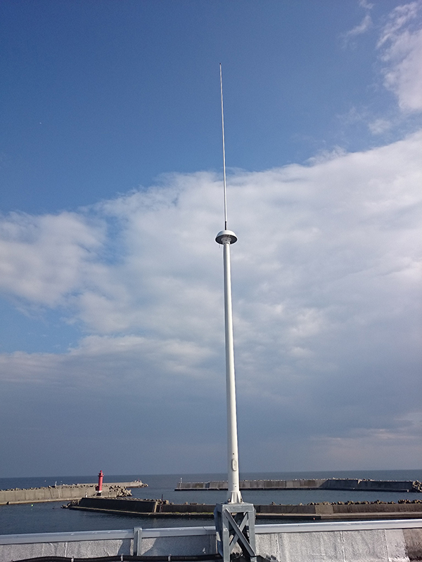
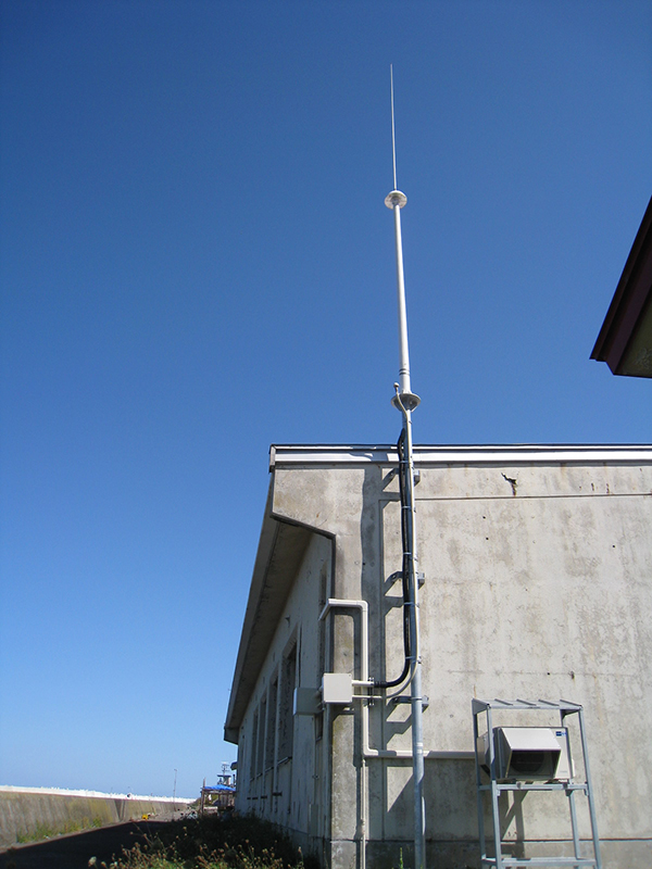
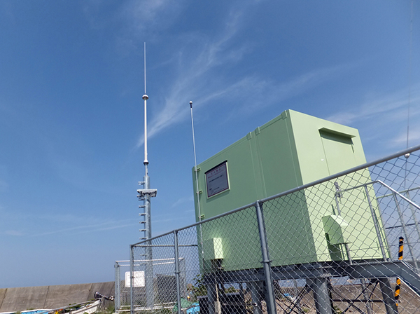
About HF radar system (High frequency ocean radar system)
HF radar stations irradiate the ocean surface with radio waves and receive backscatter. Radial vectors are obtained from the backscattering spectrum (Doppler shift measurement). The radar system installed at the eastern Tsugaru Strait, SeaSondeR, was manufactured by CODAR Ocean Sensors, Ltd. and uses a 13.9 MHz band HF radio wave. The observational range of the radial vectors is 3 to 60 km and the spatial resolution is ~3 km. The 2D ocean current vectors are computed by synthesis of the radial vectors at areas of overlap of the observational ranges of two or more radar stations. Please refer to Fujii (2004) for more information about the principle of measuring ocean currents using HF radar.
Reference : Fujii (2004) Introduction of High-Frequency Ocean Radar: Technology and History., Bulletin Coastal Oceanogr., 41, 73-82 (in Japanese with English abstract)
[Esan]
[Iwaya]
[Ohata]
Contact:

 Data Policy