

Title
MIO Ocean Radar data Site for Easter Tsugaru Strait
Abstract
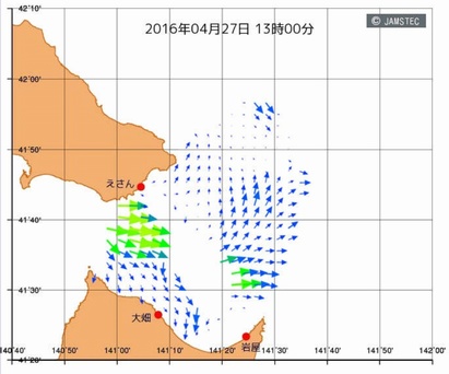
Mutsu Institute of Oceanography carries out the observations of the ocean surface east of the Tsugaru Strait by the short-wave radar sites located at Ooma-cho of Hakodate City (Hokkaido), Oohata-cho of Mutsu City (Aomori prefecture) and Higashidori Village of Shimokita county (Aomori prefecture). Observed surface current map measured by these radar sites is opened in near-real time on this site. (Currently only Japanese pages are available.)
Data Set Citation
Dataset Creator
JAMSTEC
Dataset Title
MIO Ocean Radar data Site for Easter Tsugaru Strait
Dataset Release Date
2015-09-17
Dataset Publisher
Mutsu Institute for Oceanography
Online Resource
Personnel
Role
TECHNICAL CONTACT
Contact
Mutsu Institute for Oceanography JAMSTEC (morsets-admin@jamstec.go.jp)
Keyword List
ISO Topic Category
OCEANS
Parameter
EARTH SCIENCE>OCEANS>OCEAN CIRCULATION>OCEAN CURRENTS
Platform
Ocean short-wave radar
Other
JAMSTEC
Start Date - End Date
- 2014-04-01 -
Bounding Rectangle
- South Bound
- 41.3
- North Bound
- 42.2
- West Bound
- 140.7
- East Bound
- 142.0
Location
OCEAN>PACIFIC OCEAN>Tsugaru Strait
Access Constraints
Please refer to the data policy at https://www.jamstec.go.jp/e/database/data_policy.html .
Use Constraints
Please write the application form at https://www.godac.jamstec.go.jp/morsets/e/top/ , and send it to morsets-admin@jamstec.go.jp.
Language
JAPANESE
ENGLISH
Originating Center
JAMSTEC
Organization
Organization Type
ORIGINATOR
Organization Name
Short Name
JAMSTEC
Long Name
Japan Agency for Marine-Earth Science and Technology
Personnel
Role
DIF AUTHOR
Contact
dmo@jamstec.go.jp (dmo@jamstec.go.jp)
Related URL
Description
MIO Ocean Radar data Site for Easter Tsugaru Strait - Home Page
Description
MIO Ocean Radar data Site for Easter Tsugaru Strait - Catalog Page
Last Metadata Revision Date
2022-11-21