

Title
Subduction Philippine Sea plate geometry from Nankai Trough to Nansei-shoto area
Abstract
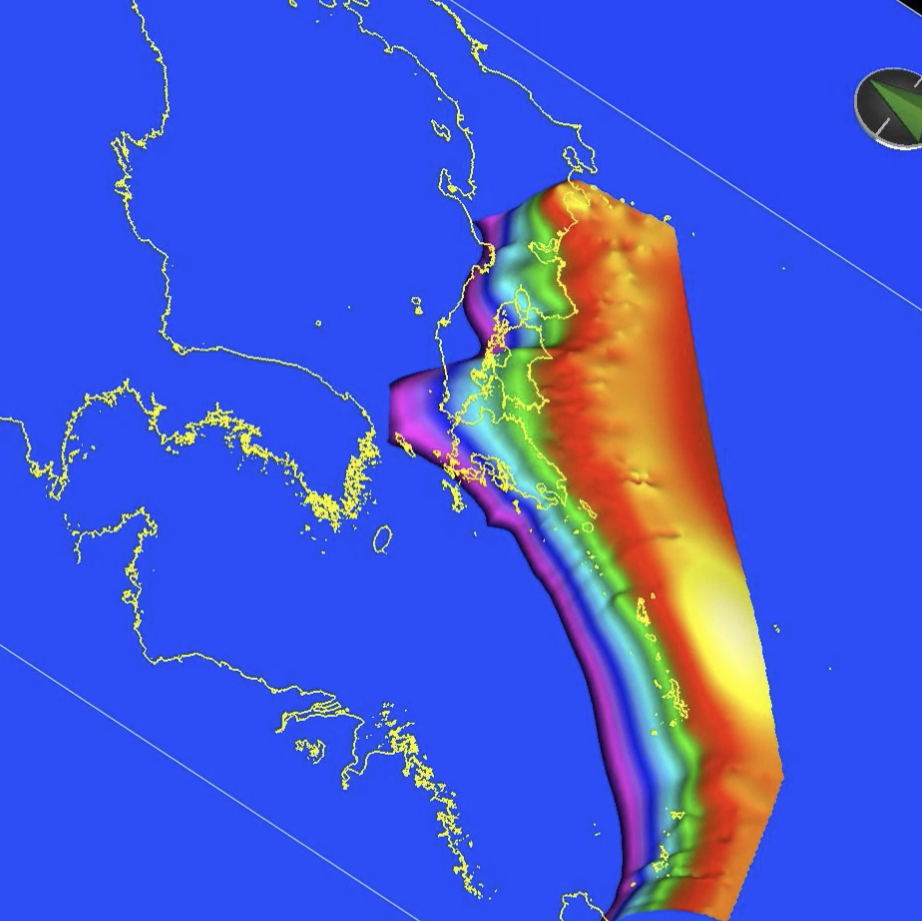
This is the page for introducing the geometry of subducting Philippine Sea plate constructed based on results deduced from seismic surveys conducted by 'Research project for compound disaster mitigation on the great earthquakes and tsunamis around the Nankai trough region' funded by Ministry of Education, Culture, Sports, Science and Technology, Japan.
Data Set Citation
Dataset Creator
Ayako Nakanishi (JAMSTEC)
Dataset Title
Subduction Philippine Sea plate geometry (in Japanese)
Other Citation Details
Data Citation: JAMSTEC (2021) Subduction Philippine Sea plate geometry. JAMSTEC. doi:10.17596/0002217 (accessed YYYY-MM-DD)
Persistent Identifier
Type
DOI
Identifier
10.17596/0002217
Online Resource
Personnel
Role
DIF AUTHOR
Contact
IMG/SDR
Keyword List
ISO Topic Category
GEOSCIENTIFIC INFORMATION
Parameter
EARTH SCIENCE>SOLID EARTH>TECTONICS>PLATE TECTONICS
Platform
Other
JAMSTEC
Location
SOLID EARTH>CRUST
OCEAN
Originating Center
JAMSTEC
Organization
Organization Type
ORIGINATOR
Organization Name
Short Name
JAMSTEC
Long Name
Japan Agency for Marine-Earth Science and Technology
Personnel
Role
DATA CENTER CONTACT
Contact
dmo@jamstec.go.jp (dmo@jamstec.go.jp)
Related URL
Description
Subduction Philippine Sea plate geometry from Nankai Trough to Nansei-shoto area - Catalog Page
Last Metadata Revision Date
2023-01-06