

Title
Radar-raingauge combined gridded precipitation data
Abstract
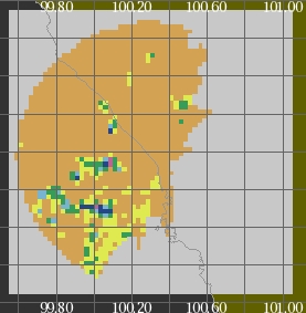
This is a gridded data set of radar and raingauge observations, which were obtained over the region of approximately 160 km by 160 km in West Sumatra for the period of one month during from October 28 to November 27 in 2006.
Data Set Citation
Dataset Creator
Center for Coupled Ocean-Atmosphere Research (CCOAR)
Dataset Title
Radar-raingauge combined gridded precipitation data (West Sumatra)
Dataset Release Date
2009-09-01
Version
1.1
Persistent Identifier
Type
DOI
Identifier
10.20783/DIAS.37
Online Resource
Personnel
Role
DIF AUTHOR
Contact
dmo@jamstec.go.jp (dmo@jamstec.go.jp)
Role
TECHNICAL CONTACT
Contact
SHUICHI MORI (Center for Coupled Ocean-Atmosphere Research) JAMSTEC (morishu@jamstec.go.jp)
Keyword List
ISO Topic Category
CLIMATOLOGY/METEOROLOGY/ATMOSPHERE
GEOSCIENTIFIC INFORMATION
Parameter
EARTH SCIENCE>ATMOSPHERE>PRECIPITATION>PRECIPITATION AMOUNT
Platform
In Situ Land-based Platforms
Other
JAMSTEC
Start Date - End Date
- 2006-10-28 - 2006-11-27
Bounding Rectangle
- South Bound
- -1.55
- North Bound
- -0.05
- West Bound
- 99.55
- East Bound
- 101.05
Location
GEOGRAPHIC REGION>TROPICS
Data Resolution
Latitude Resolution
0.025 degrees
Longitude Resolution
0.025 degrees
Temporal Resolution
30 minutes
Project
Short Name
HARIMAU
Short Name
DIAS
Long Name
Data Integration and Analysis System
Access Constraints
Please see to the Related URL for the data file.
Language
JAPANESE
ENGLISH
Originating Center
JAMSTEC
Organization
Organization Type
ORIGINATOR
Organization Name
Short Name
JAMSTEC
Long Name
Japan Agency for Marine-Earth Science and Technology, Japan
Personnel
Role
TECHNICAL CONTACT
Contact
dmo@jamstec.go.jp (dmo@jamstec.go.jp)
Related URL
Description
DIAS
Description
Radar-raingauge combined gridded precipitation data - Catalog Page
Last Metadata Revision Date
2022-11-29