SHINKAI 6500 Dive 0612
Videos/Photos


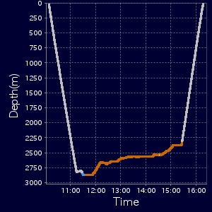
 Time Series of Depth
Track Color:
mid-water
sea-floor
no videos
Mouse Operation on 3D
 You can click dive track to focus a corresponding area on graph and timeline.
Zoom: scroll wheelRotate:
left click & dragChange view:
right click & drag


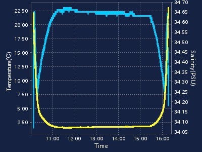
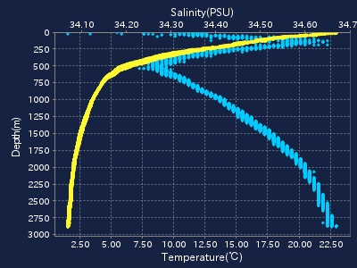
 Dive Data
Dive Data
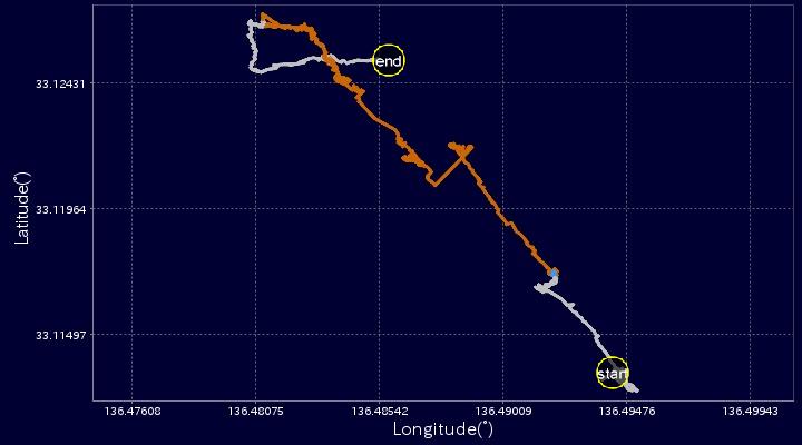
2D Track

Time Series of Depth
■Data Policy ■Site policy
■Terms and Conditions
■Contact
■Privacy Policy
■Site policy
■Terms and Conditions
■Contact
■Privacy Policy
Copyright 2014 Japan Agency for Marine-Earth Science and Technology
■Site policy
■Terms and Conditions
■Contact
■Privacy Policy
Copyright 2014 Japan Agency for Marine-Earth Science and Technology